CALIFORNIA WIRT COUNTY OIL GHOST TOWN ON STAUNTON-PARKERSBURG TURNPIKE - California Hotel-Tavern Had 25 Rooms Before 1850
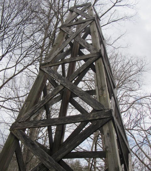
Oil derrick replica along highway denotes long-gone
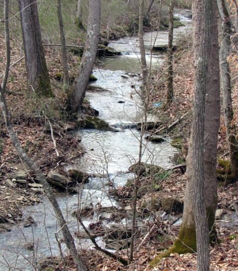
California, nearby stream empties into Hughes River
By Bob Weaver
The place name of California in Wirt County, West Virginia (near Ritchie County line) along the historic Staunton-Parkersburg Turnpike/Route 47 (Hughes River), would have likely faded had historian David McCain (WV Oil and Gas Museum) constructed a small recognition site at the location a few years back, it too now fading.
The 180-mile long Staunton-Parkersburg Turnpike, built by Virginia about 1835, was a sweat by thy brow engineering marvel built by immigrants, to open up Western Expansion
Digger George Lemon recovered "sand oil" at California in 1819 from hand dug pits, 20 miles east of Parkersburg. Later he drilled a well for salt, which also produced oil, using water power from the Hughes River, a first for the industry.
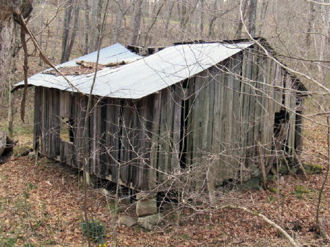
Structure said to be last remnant of the California hotel-tavern
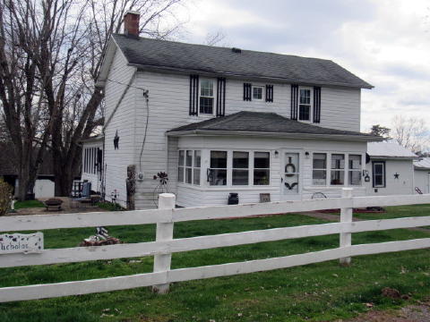
Historic Daubenspeck Homestead nearby
Entrepreneur Bushrod W. Creel owned the land on which Lemon was working, and had Lemon ousted. This was the first documented oil rights legal dispute. He accumulated considerable wealth from oil. Creel also had a 25 room lodge and tavern for travelers along the Staunton-Parkersburg Turnpike named "California House." Since many travelers were headed west to the California gold rush, they often asked Creel if he was going west. He replied, "No, I am going to stay here and get rich." He did.
The road was a busy place during the Civil War.
Creel sold 100 barrels of oil annually before 1840, mostly for medicinal purposes.
More oil was found in the sands of the Hughes River by 1840, then called sand oil.It was found by digging holes or pits from three to five feet deep. Digging through the surface a vein of sand would be found, which contained water and oil.
The water would rise in the holes or pits, and the oil settled on top of the water. The manner in which the oil was gathered or secured was to take a woolen blanket and spread it on the surface of the pool, and when it became saturated with the oil, take it up and wring the oil out of it into barrels.
By today's
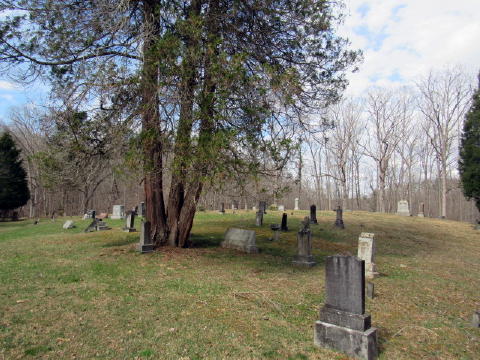
Nearby Freeport Cemetery houses early newcomers
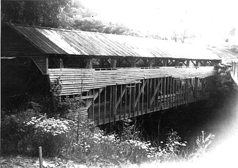
A covered bridge that once crossed Goose Creek at Freeport, Wirt County, part of the Staunton/Parkersburg Turnpike. The turnpike was completed to Parkersburg by 1847. Many of the covered bridges on the Pike were built by master carpenter, Lemuel Chenoweth. This bridge was razed in the late 1930s or early 40s.
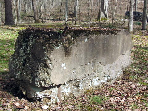
Remnant of historic oil days rests in woods
This was a slow process, and not many barrels could be obtained annually, as the work could only be done in warm weather. Such oil as was gathered, however, brought wonderful prices, for it was sold as a medicine. Bushrod W. Creel was the gentleman that managed the enterprise.
The first oil well at California was sunk in 1859 by Charles Shattuck and T. T. Jones, about the same time as the well sunk by Edwin Drake near Titusville, Pennsylvania, often referred to as the first commercial oil well. This has led to some dispute as to which well was the earlier, with historian Kain saying it was in West Virginia.
After the Civil War, the development of more productive oil fields led to the gradual abandonment of oil production at small wells such as those at California, Petroleum, and Burning Springs. In 1924, there were six houses and eleven oil wells in the immediate vicinity and the defunct California House, with fifteen more wells along a ridge on the south side of the Hughes River. In 1957, there were three wells remaining at or near California, and four more across the river.
The off-road neighborhood has about six families.
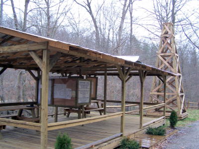
EARLY OIL PRODUCTION - Shelter, signage and derrick mark
the return of the Village of California to West Virginia
landscape on Rt. 47, thanks to the late David McKain
WIRT'S HISTORIC CALIFORNIA MARKED BY MUSEUM IN 2007
By Bob Weaver 2007
California, West Virginia is back on the map, a project completed in 2007.
The long faded village is located on the 180-mile Parkersburg-Staunton Turnpike (Route 47) 27 miles from Parkersburg in Wirt County, a short distance from Freeport.
David McKain's Oil, Gas and Civil War Heritage District has just developed the California site, one of several celebrating the birth of the nation's oil and gas industry as well as related Civil War activities.
The anchor for the district is the Oil and Gas Museum in Parkersburg.
California is where the nation's first commercial oilfield was developed in 1819, with the first drilled well in 1859.
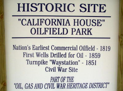
California was one of many way-stations in 1851 along the historic Staunton-Parkersburg Turnpike, and during the Civil War, both Union and Confederate forces traveled on the turnpike and frequented the California House and tavern.
The turnpike has received the designation as a National Scenic Byway by the Federal Government because of its transportation significance.
The Pike was initially authorized in 1826, and planned and laid out by the state engineer of Virginia, Claudius Crozet.
It was not actually built until the 1840's, with completion of the main roadway in 1848. This road, traveling over the high mountains near the birthplace of rivers was an engineering marvel, and opened up large sections of western Virginia to settlement and commerce.
The California site is the location of early trenches that were dug and from which oil was barreled and commercially distributed to Parkersburg and Marietta, Ohio from the early 1800s.
The site is also known for a famous water well, which produced marketable oil in the early 1850s. It was sold to the famous Samuel Kier, developer of the Kerosene lamp in early August, 1859.
A well was being commercially drilled for oil in the spring and summer of 1859 by Charles Shattuck and J. T. Johnston, at the same time as the famous Drake well was being drilled in Pennsylvania.
California became a significant oilfield in the 1860s and 1870s and the area still contains numerous producing oil and gas wells.
The Oil and Gas Museum currently owns five acres at the site. The original foundation stones of the California House, water well and barn are still located on the museum property.
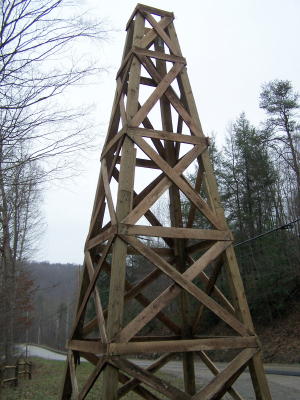
Oil derrick replica along Rt. 47, Staunton-
Parkersburg Turnpike - site of California House
Other projects in the district already developed or planned, include:
- Burning Springs, seven miles from Elizabeth in Wirt County, the park is already in place.
- Palestine Lock and Dam site, Wirt County.
- Big Bend Rebel Civil War site, Calhoun County.
- Oil Rock, off Standing Stone Creek in Wirt County, a post Civil War boomtown.
- Ritchie Mines, north of McFarlan in Ritchie County.
- Petroleum, in Ritchie County.
- Volcano, in Wood County, 20 miles from Parkersburg on U. S. Rt 50.
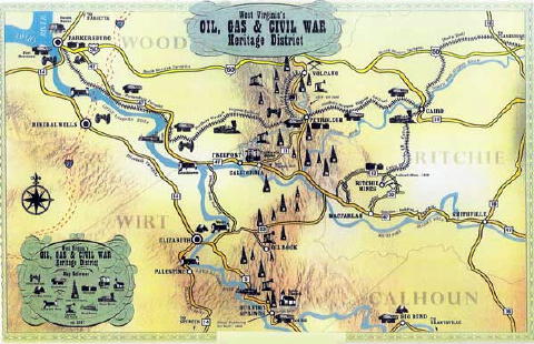
Oil, Gas, Civil War Heritage District from Oil and Gas Museum, Parkersburg. Courtesy of www.little-mountain.com/oilandgasmuseum