CALHOUN SPRINGS FORTH FROM VAST WILDERNESS - Early Comers Looking For Peace, Melungeons Came To County, 354 vs 655 Still Alive, A Blessed Place
It has been a few moments on the time calendar since native Americans dominated the Calhoun forest, mostly using it for hunting grounds. The Delaware, Iroquois, Seneca, Cherokee, Shawnee and others traversed the Little Kanawha Trail, connecting with the higher mountains of the east to the great Ohio River valley.
The French laid ownership to what is now Calhoun in 1749, based on claims made by their explorers in the 1600s when they crossed the wilderness area.
While Virginia claimed the wilderness, there is no record that their explorers set foot on the area until the mid-1700s. Virginia made a deal with the Indians for the land in the 1744 and 1752 - the Treaty of Lancaster and the Treaty of Logstown.
Within a few years Virginia created land companies which began to sell or issue land grants in the 1700s, many of which early Calhoun residents later acquired to begin their life in the wilderness.
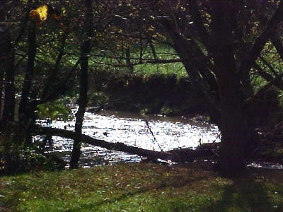
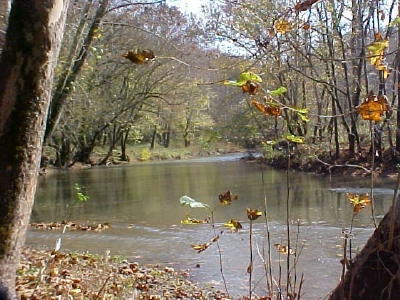
Christopher Gist, working for the Ohio Land Company, traveled through the Little Kanawha River valley in the 1750s, the river then known as Sipia or Naemas River.
The British and the French went to war over the wilderness area, the conflict ending in 1763.
George Washington had an intense interest in the area, desiring to improve transportation and open it for land development. He recognized the Little Kanawha River as an east-west connector by 1770.
Washington wrote in his diary: "This day was visited by one Mr. Ennis who traveled down the Little Kanawha from the head to the mouth ..." essentially denoting Ennis as the first "official" explorer in Calhoun County.
Writing about the Little Kanawha, Washington said "This is about as wide as the Muskingum, but the water is much deeper, it runs toward the inhabitants of the Monongahela ... navigable by canoe". Then came the American Revolution, disrupting Washington's explorations, but reports continued from other early trailblazers, many who interestedly were digging and marketing ginseng.
A group of Randolph County explorers, William White, Thomas Drennen, Paul Shaffer and John Cutright recorded their journey through Calhoun in 1770.
More notable was the legendary journey in 1772 by William Lowther, Jesse Hughes and Elias Hughes from the Harrison-Lewis West Fork River region to this area, naming many of the streams.
A number of Hughes descendants settled in Calhoun and remain today.
Explorers seeking a new life began to claim land in Calhoun, including John Dragoo at Big Bend in 1772. John Gibson and his family settled on 400 acres on the West Fork of the Little Kanawha, then part of Wirt County. Indians captured Gibson's family in 1880.
Abraham Thomas settled on 400 acres with "corn rights," likely the first certified settler within the borders of the county in 1774, but it was Edward Tanner who obtained 1,000 acres along the West Fork of the Little Kanawha that appeared to "settle" and his family members went in several directions, originals to Spencer and Tanner, now Gilmer County.
The new United States government allowed settlers to claim 400 acres, with additional permission to purchase 1,000 acres next to their property.
Many claims were made by absentee owners who never lived on the land. Phillip Starcher was the first permanent settler in Lee District in 1810, below Arnoldsburg. The Washington-Lee districts were also settled by Peter Cogar, Sr., Issac Mace, Sr., William Brannon, Arnold, Peter McCune, Sr. and "No Moss Under My Feet" Adam O'Brien.
Other early Washington district families included Parsons, Cook, Connolly, Knotts, Brannon, Hamilton, Jarvis, Cottrell, Nicholas, and Truman.
Perhaps in the northern part of Calhoun the most significant early-comer was Michael Stump, whose descendants now number tens-of-thousands.
Thomas Holbert built the first log cabin in Center District, with other early pioneers in the northern area, Maze, Jackson, Cox, Haverty, Burris (Burrows), Hardman, Riddle, Bell, Ferrell, Stallman, Goff, Ball, Westfall, Barr, Huffman and Smith.
Calhoun was once part of other geographic regions, Augusta, Monongalia, Greenbrier, Harrison, Lewis, Kanawha and Gilmer.
By 1844 there were calls to create a new county for the area, with Gilmer County being chartered in 1845.
While there were a number of leaders in the movement to create Calhoun, it may well be that Arnoldsburg resident Peregrine Hays was among the most significant players. Hays, prior to 1856, circulated a petition for the Washington-Lee part of the county to become part of California County, which was later to become Roane County.
Still, he was the principal supporter in having the seat located at Arnoldsburg, but just in case he purchased land west of Grantsville.
It was official on March 5, 1856 - the new county of Calhoun.
The county government shifted back and forth between the Arnoldsburg and Grantsville areas several times after the county was created.
Though county government was suspended during the Civil War, animosity continued after the conflict between northern and southern sections.
Perhaps, Calhoun's untold story is about why many early-comers lodged themselves in the narrow hollows with little flat land, instead of going a little further west when the land provided greater opportunities.
It is clear these past 150 years that Calhoun citizens have been hardy souls, survivors.
Many of them stuck to the Calhoun sod because they were escaping persecution. Some of our ancestors were Melungeons, mixed race people, not just African American, but outcasts who didn't have acceptable "bluish-blood." Prejudice disallowed them a place in frontier society.
The mulungeons, dark-skinned, blue-eyed people of european, middle-eastern, native American and native African descent, escaped into the American wilderness before 1700 into North Carolina, Virginia, Tennessee, and Kentucky, looking for freedom.
The outcasts hid themselves in the mountains. They had no rights.
Several of them discovered Calhoun County and West Virginia, where they found what they were looking for, a little peace in the most hilly region on earth.
Today, we would more than likely just call them immigrants.
To this day, living here in the backwoods requires commitment, sacrifice and using a buck very wisely.
Beyond the longstanding north-south differences, now called 354 vs 655 (the north-south telephone exchanges) in this most rural county, when the chips are down and neighbors are needed, all come together.
The north-south division continues to be given new life to politicians who enhance their chances of being elected by drawing a north-south line.
Despite it all, including long-standing poverty and the globalization of production jobs in the region, it is a blessed place.
Bob Weaver